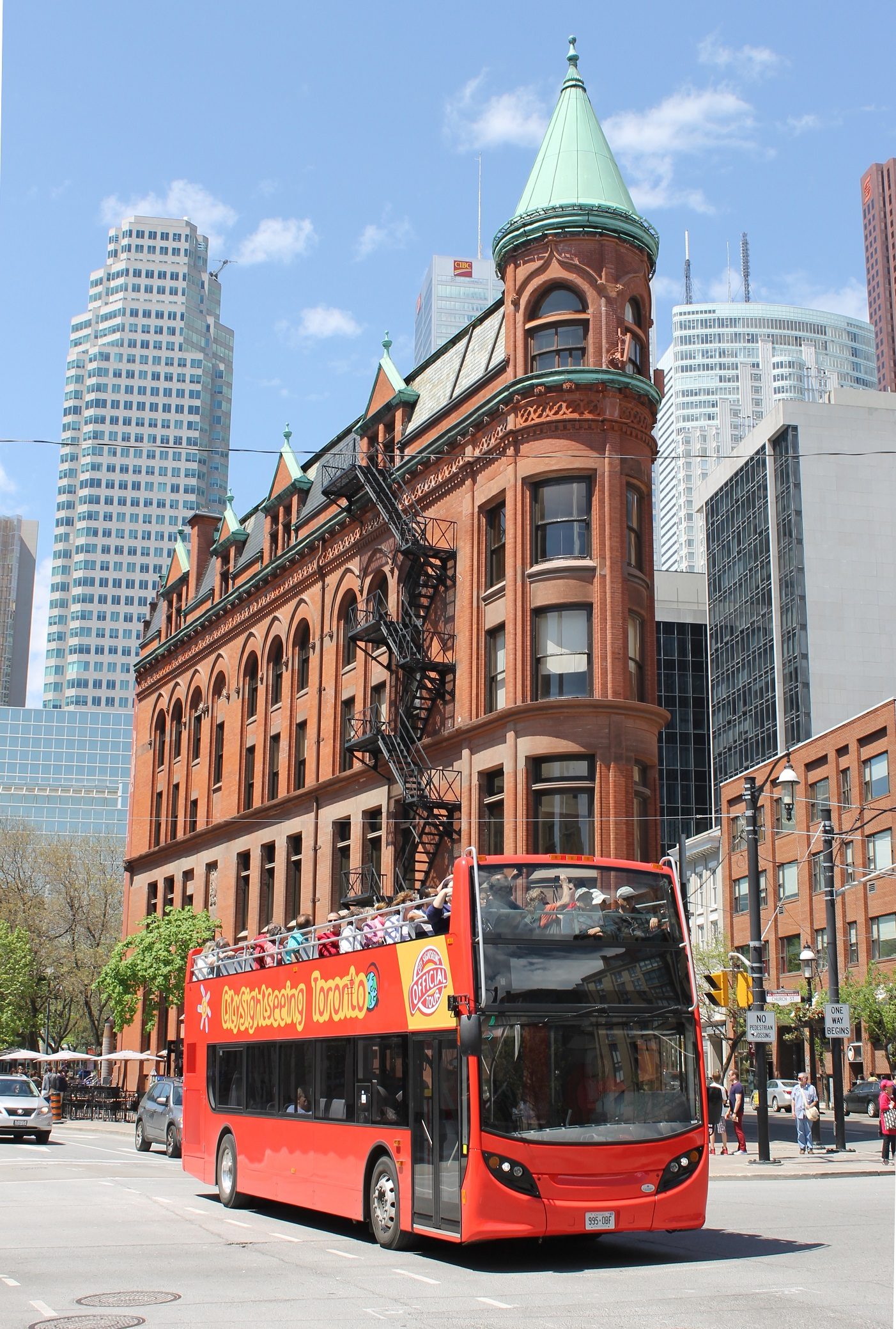
Toronto City Bus Tour
Route Guide

Toronto City Bus Tour Map

Understanding the toronto city bus tour map before you board saves time and helps you plan a route that hits your priority landmarks without backtracking. The network loops through downtown and waterfront districts with 24 designated stops, each marked by City Sightseeing signage and staffed during operating hours.

9 min read Updated 2026-10-01 Fact-checked
Toronto City Bus Tour Map

Quick answer

The toronto city bus tour map covers a continuous loop connecting 24 stops across downtown Toronto, the Distillery District, Harbourfront, and Casa Loma. The full circuit takes approximately 90 minutes without disembarking, and buses arrive at each stop every 20–30 minutes during peak season. The route is unidirectional, so plan your hop-off points strategically to avoid traveling the full loop to reach a nearby landmark.

City Sightseeing operates Toronto's primary hop-on hop-off network from a base depot at 1 Dundas Street East, though passengers can board at any marked stop along the circuit. The toronto city bus tour map depicts a single continuous route rather than multiple color-coded lines, simplifying navigation for first-time visitors but requiring some advance planning to optimize your itinerary. The route divides naturally into three zones. The downtown core section runs from Yonge-Dundas Square through the Financial District and Entertainment District, serving high-density attractions like the CN Tower, Ripley's Aquarium, and Rogers Centre. The eastern leg extends into the cobblestone Distillery District, a pedestrian-only heritage zone that warrants at least 90 minutes on foot. The waterfront and western section sweeps past Harbourfront Centre, climbs toward the University of Toronto campus, and terminates the loop at Casa Loma before descending back downtown. Buses display the next three stops on digital boards mounted near the driver, and live GPS tracking through the operator's mobile app shows real-time vehicle locations. Physical printed maps are distributed on board and available at the main departure point, though the digital version updates more frequently during service disruptions or weather delays. Most stops feature sheltered seating and route signage in English and French, with landmarks visible from the stop to confirm your location. The unidirectional circuit means missing your intended stop requires riding the full 90-minute loop to return, so consult the toronto city bus tour map before disembarking. Stops near major intersections like King and Bay or Front and Yonge serve as practical transfer points if you need to backtrack by streetcar or subway. The route remains consistent year-round, though winter schedules reduce frequency and some exposed stops lose shelter amenities during heavy snow. Plan your sequence to minimize backtracking—grouping Harbourfront, the CN Tower, and the Distillery District into a single eastern pass works more efficiently than zigzagging. The Casa Loma stop sits at the route's geographic extremity, making it a natural first or last destination rather than a mid-itinerary detour.

“The route's unidirectional design means missing your stop requires riding the full 90-minute circuit to return.”
Itinerary

Navigating the Toronto City Bus Tour Map: Route Overview and Duration

This plan suits a first-time visitor who wants to ride the full circuit once, end to end, before deciding where to hop off on a later lap. Allow roughly two hours for the complete loop without leaving the bus, plus a few minutes of boarding time at the start.

09:00

Board at 1 Dundas Street East

Join the bus at the Yonge-Dundas Square stop, the route's main anchor point, and head upstairs if the top deck has space. Boarding and settling in takes about ten minutes.

09:15

Downtown core and Old Town

The bus rolls south through the financial district past the Hockey Hall of Fame and into the St Lawrence Market area. Commentary runs continuously, so grab a seat near a speaker if the wind is strong up top.

09:40

Distillery District loop

The route swings east through the cobbled Distillery Historic District before turning back west. This is the stretch most riders mark for a return hop-off, so note the stop number as you pass.

10:05

Harbourfront and ferry docks

The bus tracks the waterfront past Harbourfront Centre and the Jack Layton Ferry Terminal. Expect the slowest traffic of the loop here on weekends.

10:25

CN Tower and Rogers Centre

The circuit passes the base of the CN Tower, Ripley's Aquarium and Rogers Centre in quick succession. Have your camera ready before the bus turns, since the tower fills the frame only briefly.

10:45

Fort York and Bathurst turn

The western arc covers Fort York National Historic Site and the Fashion District. Stops are spaced further apart here, so the bus moves at a steadier pace.

11:00

Queen Street and Nathan Phillips Square

The return leg heads north and east past Old and New City Hall. Keep your ticket visible if you intend to change buses at this point.

11:15

Full loop complete

You arrive back at the starting stop having seen the whole circuit. Stay aboard for a second lap or step off and rejoin any later bus at the same stop, since the hop-on hop-off system lets you re-board as often as you like within your ticket's validity.

What to see

Key Landmarks on Your Toronto City Bus Tour Map

The Toronto city bus tour route covers several major districts and landmarks, offering a vantage point for viewing the city's architectural and cultural history. From the top deck, riders can observe key sites across the downtown core and waterfront.

CN Tower

CN Tower

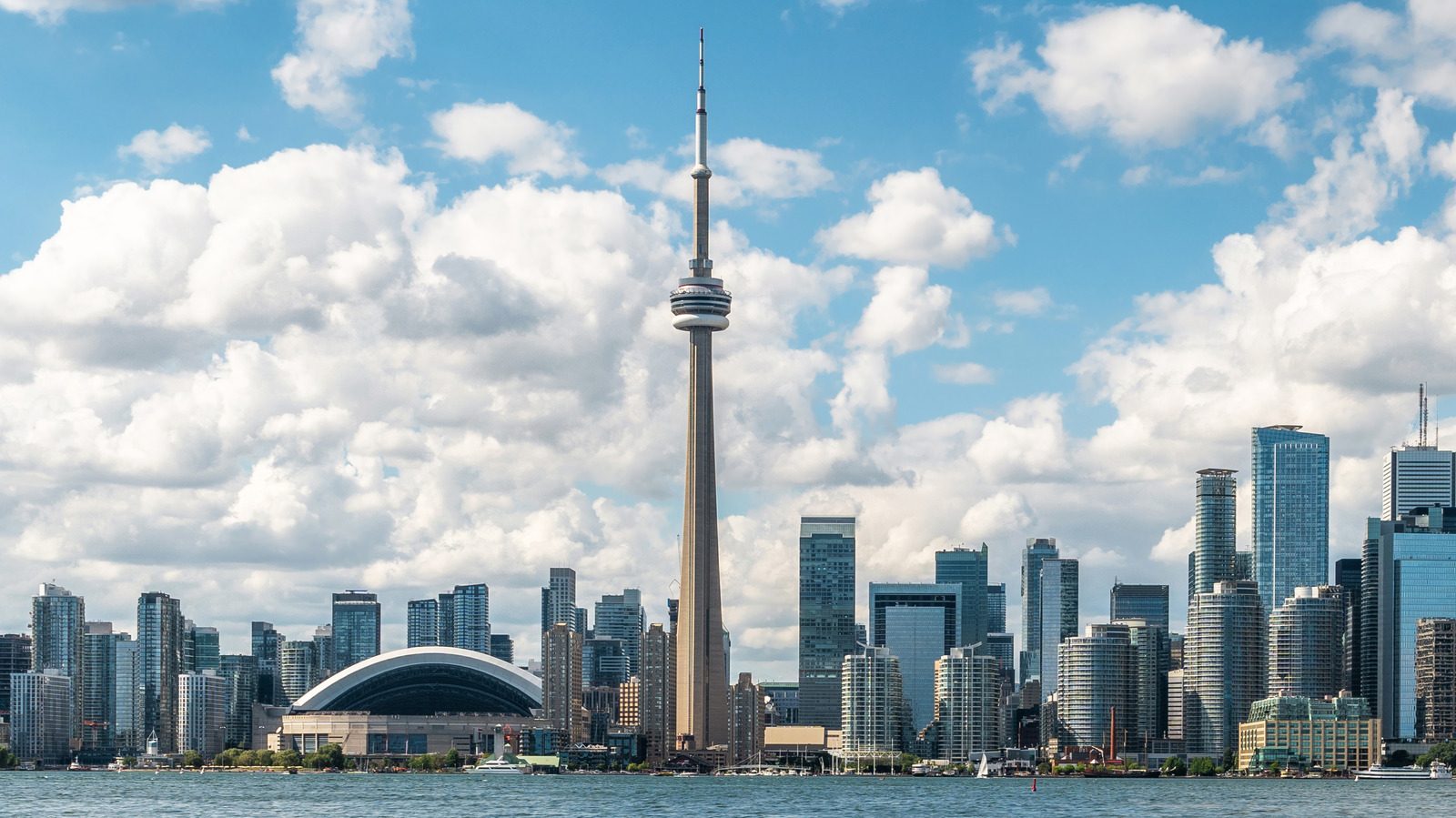
The 553-meter concrete communication and observation tower dominates the skyline and serves as a central reference point for the city. It remains one of the most prominent structures visible from the bus route.

Look up to see the glass floor observation deck exterior.
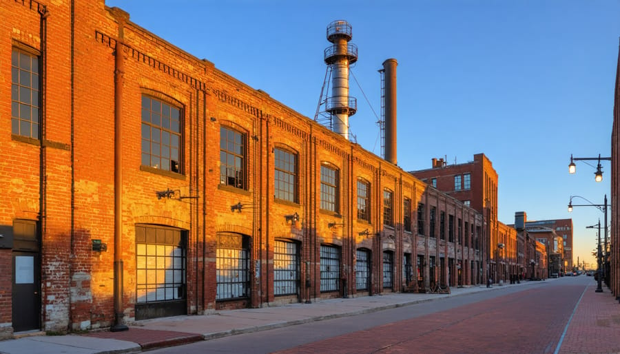
Distillery District

Distillery District

This pedestrian-only village features well-preserved Victorian industrial architecture and brick-lined streets. It is home to various galleries, boutiques, and cafes.

Scan the side streets for original 19th-century red brick facades.

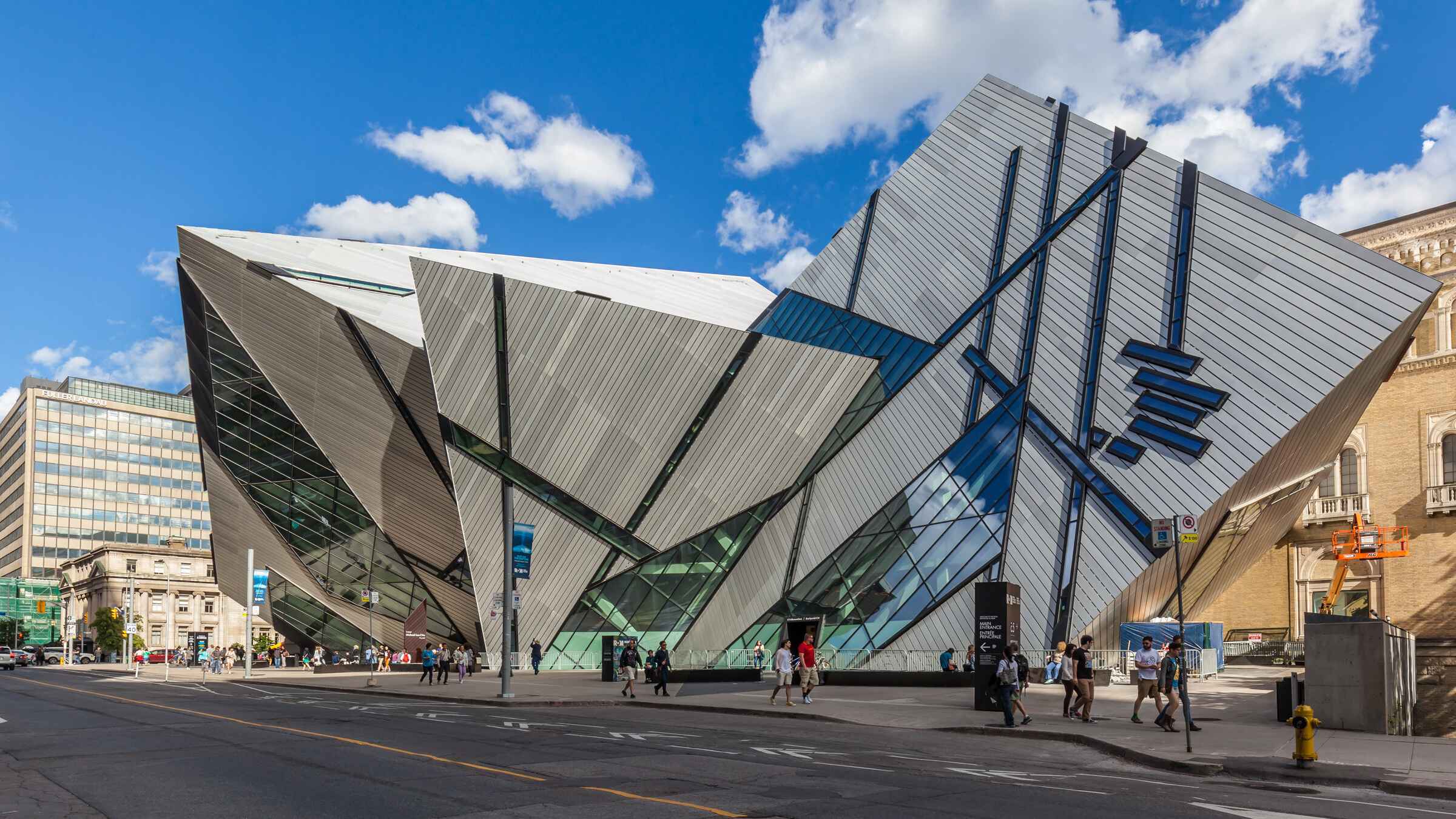
Royal Ontario Museum

Royal Ontario Museum

This institution combines historic stone architecture with the angular, metal-clad Michael Lee-Chin Crystal addition. It occupies a prominent position in the Bloor-Yorkville area.

Observe the contrast between the historic facade and modern glass.

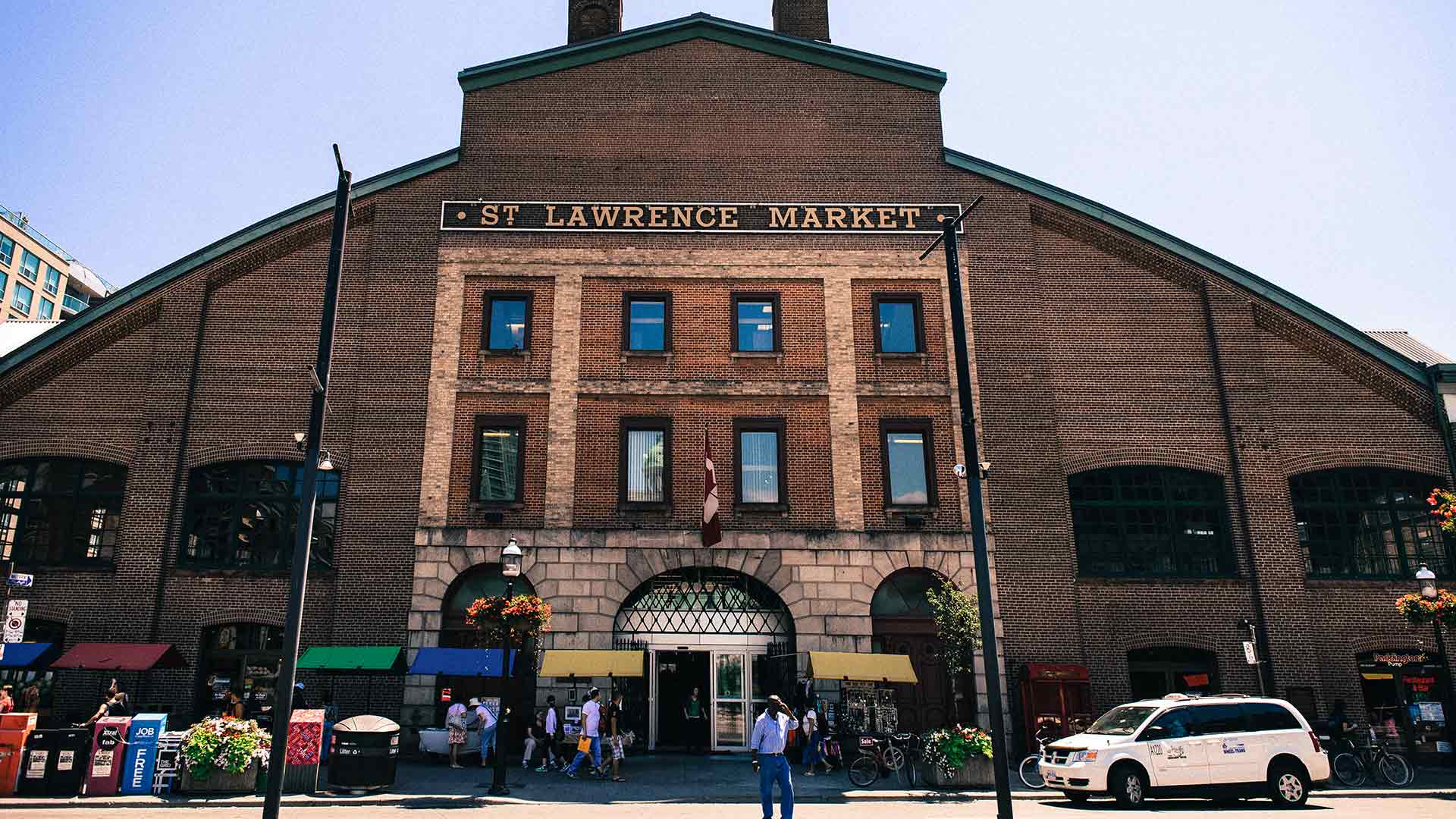
St. Lawrence Market

St. Lawrence Market

Recognized for its historic south market building, this site has served as a central food hub since the early 19th century. The bus passes near the intersection of Front and Jarvis streets.

Check the south side of the street for the clock tower.

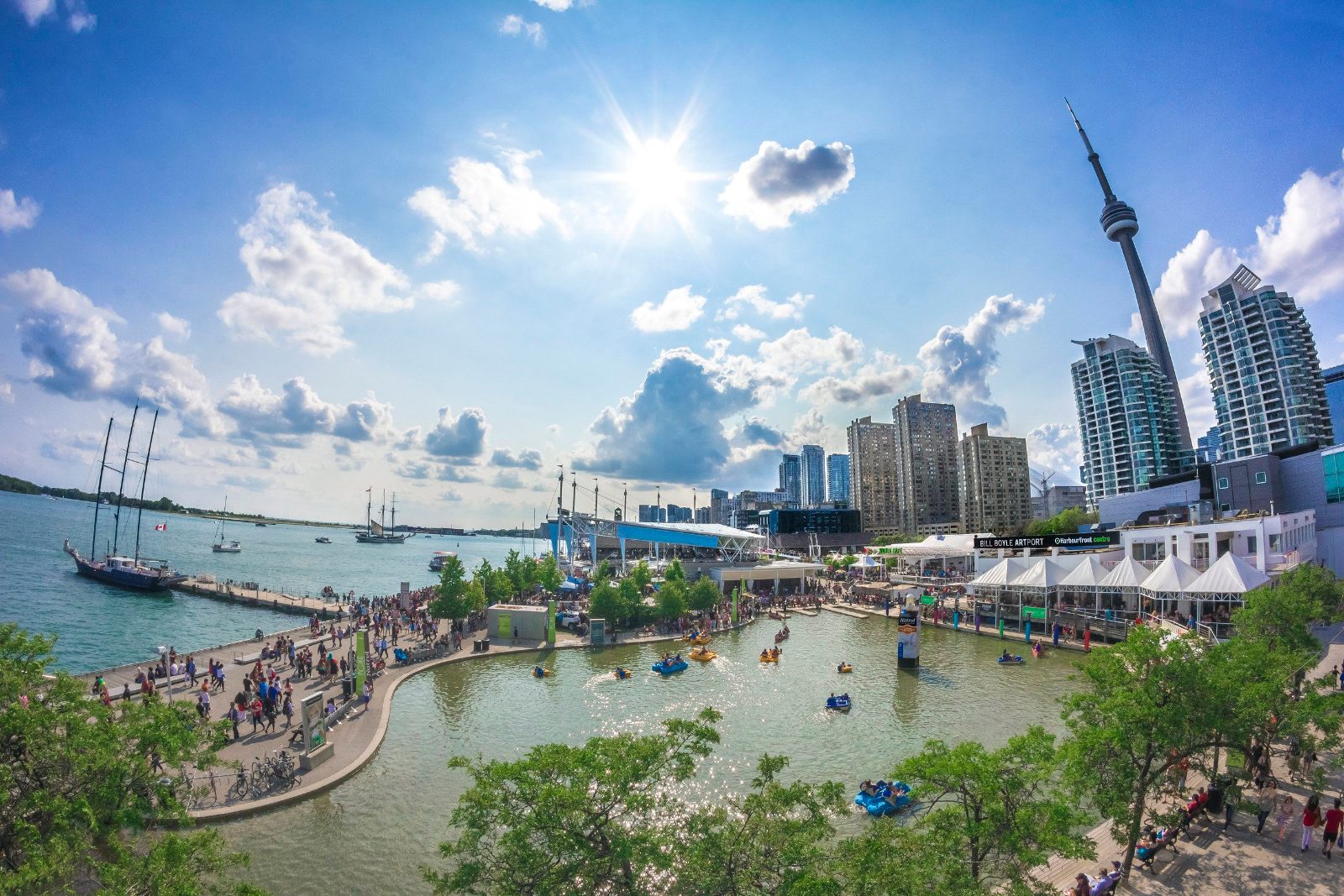
Harbourfront Centre

Harbourfront Centre

Located along the shore of Lake Ontario, this cultural hub offers views of the waterfront parks and ferry docks. It provides a distinct perspective of the city's relationship with the water.

Watch for the lake views as the bus drives parallel.

Timing

Optimal Timing for Your Toronto City Bus Tour Map Exploration

The best arrival window is 09:00–16:30 daily, specifically between 09:00–10:30, to board early for top-deck seating and avoid mid-day tour bus crowds. Planning your tour during these morning hours allows for a more relaxed experience as you navigate the route.

Late Spring (May–June)

Moderate crowds; schools in session

Mild temperatures; 15°C to 22°C. These months offer comfortable touring conditions before the peak summer heat.

Summer (July–August)

High crowds; tourist peak

Warm to hot; 20°C to 27°C. Expect increased wait times and busier boarding areas during this period.

Early Autumn (September–October)

Lower crowds; pleasant weather

Cooler temperatures; 10°C to 18°C. This period provides clear views and comfortable seating on the upper deck.

Weekday Mornings

Low to moderate

—

Arriving at 09:00 ensures better access to preferred seating and avoids the heaviest daily transit congestion.

Verdict: The optimal time for your tour is weekday mornings during May or September, arriving at 09:00 to secure top-deck seating.

Opening hours

Daily Operating Hours for the Toronto City Bus Tour Map

The Toronto city bus tour operates daily throughout the week, maintaining consistent service times to assist with your travel planning.

Monday
09:00–16:30
Tuesday
09:00–16:30
Wednesday
09:00–16:30
Thursday
09:00–16:30
Friday
09:00–16:30
Saturday
09:00–16:30
Sunday
09:00–16:30
The final bus departure of the day is at 16:30.
Directions

Arriving at the Starting Point of Your Toronto City Bus Tour Map

The central departure point for the tour is located at 1 Dundas Street East, situated directly at the intersection of Yonge Street and Dundas Street. This location is most easily reached via the Toronto subway system.

Metro 2 min 3.35 CAD

Line 1 Yonge-University to Dundas Station

Bus 5 min 3.35 CAD

Route 97 Yonge to Yonge St at Dundas St East

On foot 1 min —

From Toronto Eaton Centre

Taxi Varies by origin Varies

Drop-off at Dundas St E and Yonge St

For the best experience, arrive between 09:00–10:30; boarding during this window allows you to secure top-deck seating and avoid mid-day tour bus crowds.

Book

Check availability

Frequently asked

Frequently asked questions about toronto city bus tour map

Everything you need to know about toronto city bus tour map

Where can I view the official toronto city bus tour map?

You can view the official toronto city bus tour map on the operator's website or pick up a printed version at the departure point. Consulting this Toronto bus route guide helps you plan your stops in advance.

Does the Toronto sightseeing bus route include major landmarks?

Yes, the route is designed to pass by iconic city landmarks such as the CN Tower and the Distillery District. Following the toronto city bus tour map ensures you do not miss any of these major points of interest.

Is the hop-on hop-off bus accessible for families?

The open-top double-decker coaches are generally suitable for families and provide an engaging way for children to see the urban skyline. Please note that strollers must be folded before boarding the bus.

What is the best time to start my tour?

We recommend arriving between 09:00 and 10:30 to secure top-deck seating and avoid mid-day tour bus crowds. Checking the toronto city bus tour map before you arrive helps you identify your preferred initial stop.

How do I purchase tickets for the Toronto city tour?

Tickets can be reserved online through the official website to ensure your spot for the day. The base price for a 24-hour hop-on hop-off adult ticket is 61.06 CAD.

Can I change my plans if I miss the tour bus?

The service operates daily, allowing for flexibility if your schedule changes throughout the day. Please refer to your toronto city bus tour map to locate the next available stop if you decide to hop off and explore an area further.

Keep reading

More guides & pages